I was up early again. I did manage to get some sleep. I went down stairs and saw one of the staff standing outside having a cigarette. I went out to say hello and to seek more information on the best way to travel to Gallipoli battlefield.
While we were standing outside I noticed the shape of the moon. It was the shape of the moon on the Turkish flag. Only difference was it was upside down to how the moon is shown on the Turkish flag.
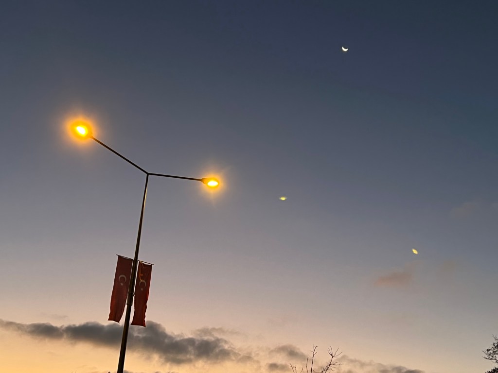
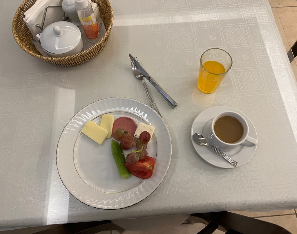
I thought l would try and take a photo that also included the Turkish flag on the road. I had a traditional Turkish breakfast.
Over breakfast l discussed with the staff and owner about the best way to get to Gallipoli battlefield. The staff member in charge of breakfast was keen for me to hire a car. But l explained to him that we drive on the other side of the road in Australia.
The owner recommended that l catch the mini bus that leaves Gelibolu for Eceabat every 15 minutes. He said from there I can catch a taxi to the battlefield. I was a bit nervous about this suggestion. But, at the end of the day it was a great idea.
It wasn’t long before the owner got his own personal car ready to take me to where l catch the bus to Eceabat. I did notice on the drive we both were wearing seatbelts and wondered why there was no dinging sound to warn us. Well, l noticed the below!

It wasn’t long before l was standing in front of my bus.

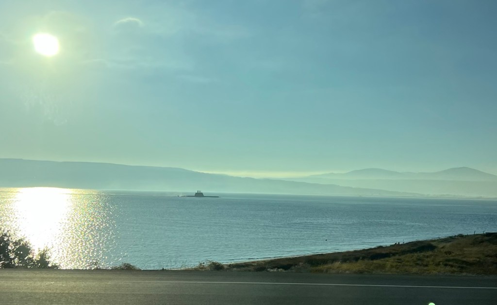
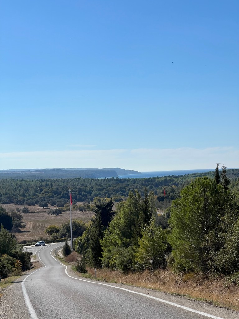
It around 50 minutes to the centre of Eceabat with the journey basically following the Dardanelles Strait.
I was a submarine on the surface making its way to somewhere!
Then a quick snap of a pillar holding the span bridge.

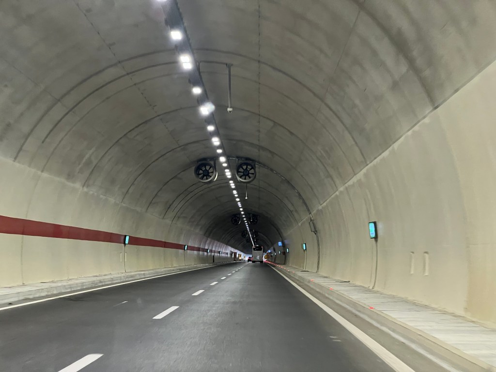
The trip to Eceabat requires vehicles to travel via several tunnels.
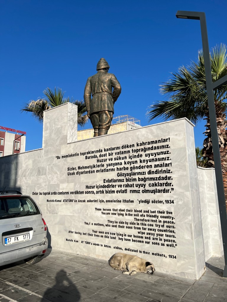
Then you arrive on Eceabat. I found this monument at the frontage before the beach.

It was written in Turkish do l’m not really sure what it is saying. A monument to Mustafa K mala A ATurk in Eceabat.

There is a moving inscription on the back in both Turkish and English. I found this quite emotional.
Then time to find a taxi for the ride to the high point of Chunuk Bair (New Zealand) Memorial. But, not without a selfie with my taxi driver.

I asked about the weather as it looked dry. He didn’t understand. So l whipped open the translation app on my phone. Eventually he understood and said they have not had rain for five months.
My plan for day is to start at the highest point to try and get as n overall view of the battlefield. Then l would make my way down on foot to the other sites
I’m glad l did this as l could go at my own pace! I did see a lot of tour buses. But, they were on very tight schedules not allowing much time at all.
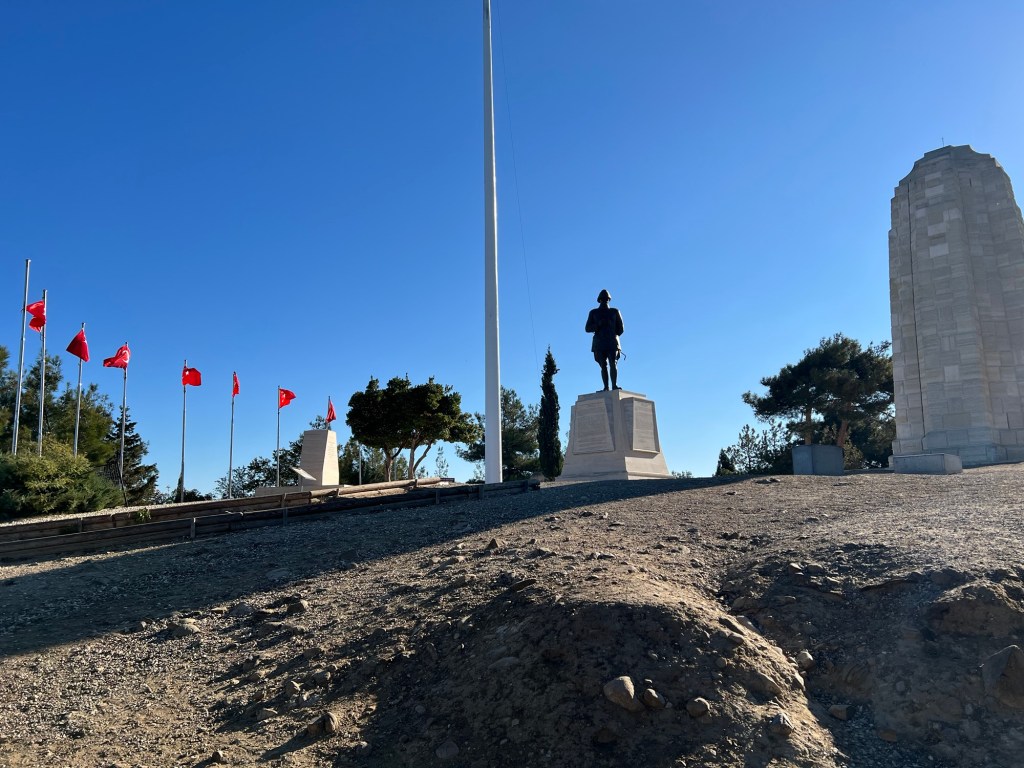
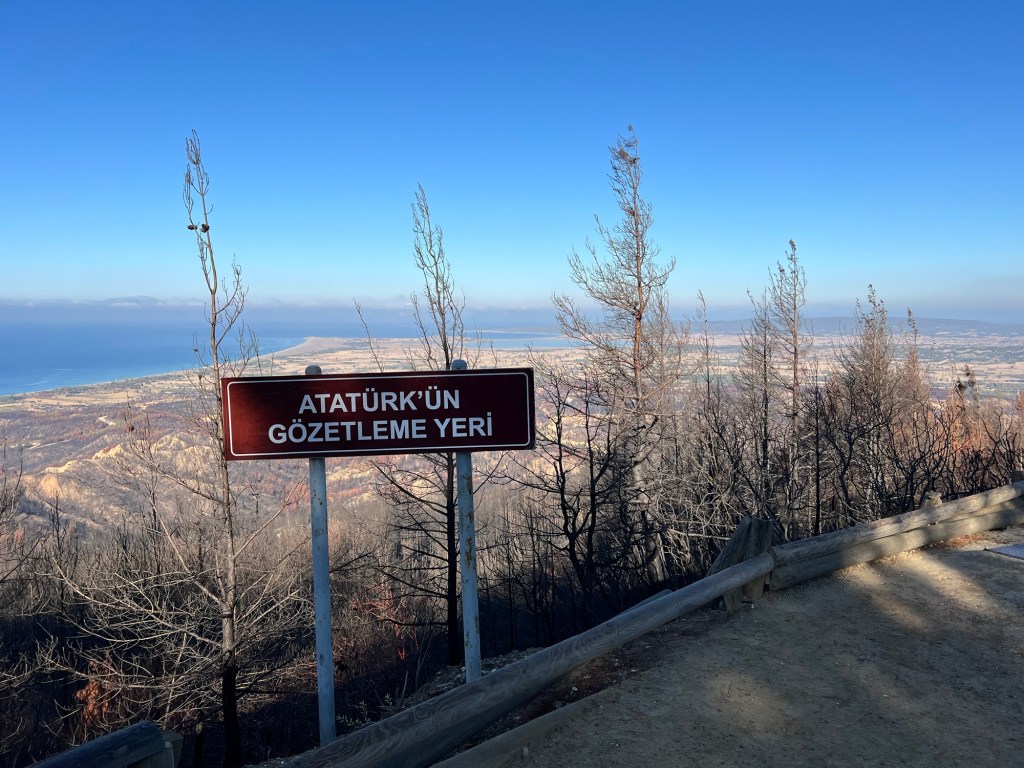
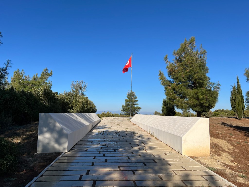
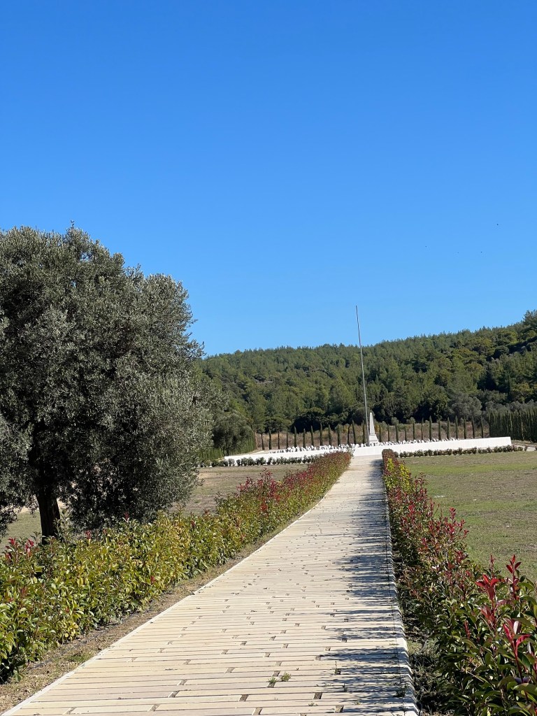
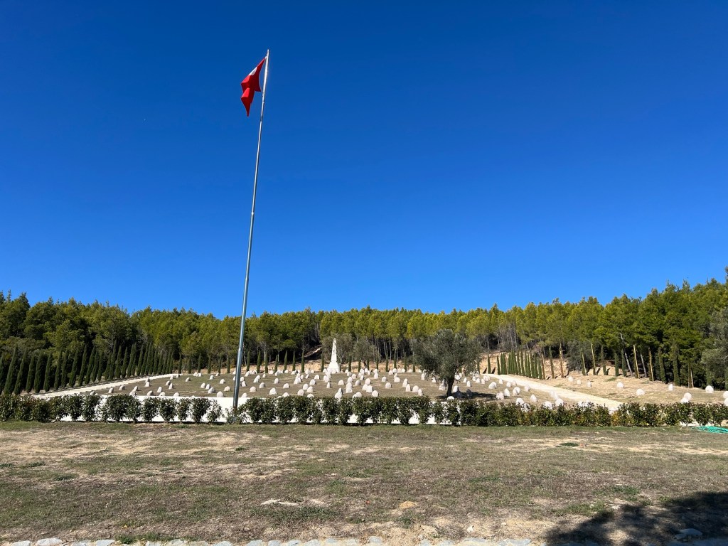
We arrived at the Chunuk Bair (New Zealand) memorial site a bit after 9am.
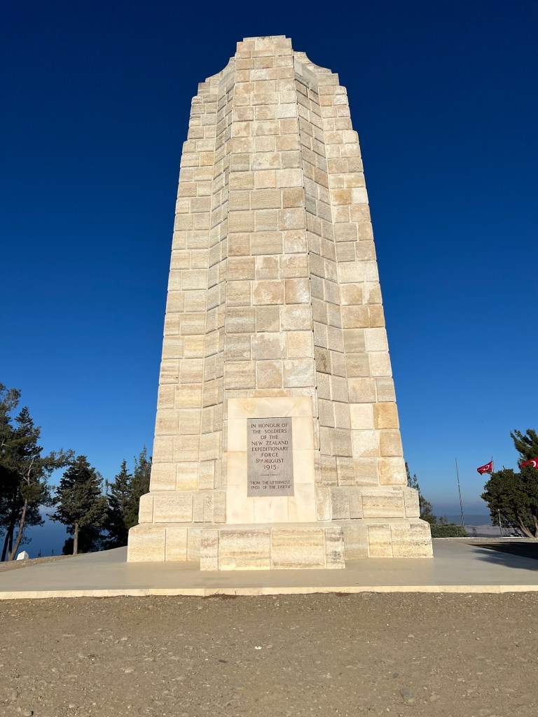
A photo with a short background to the significance of the site.
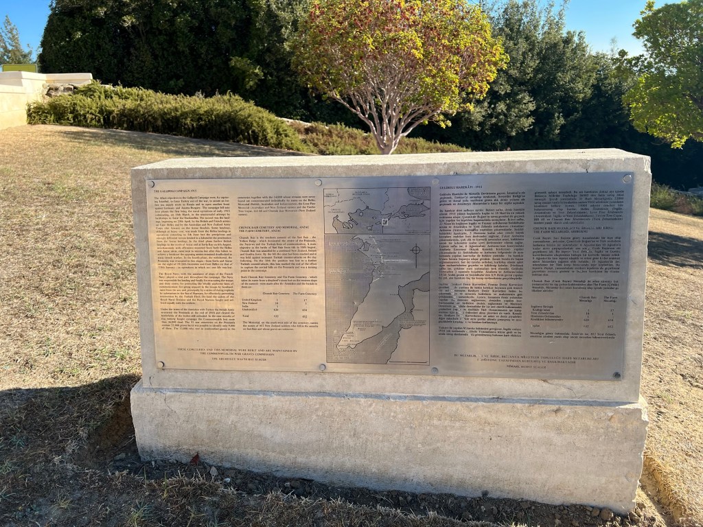
Here is a snippet from the Commonwealth War Graves website.

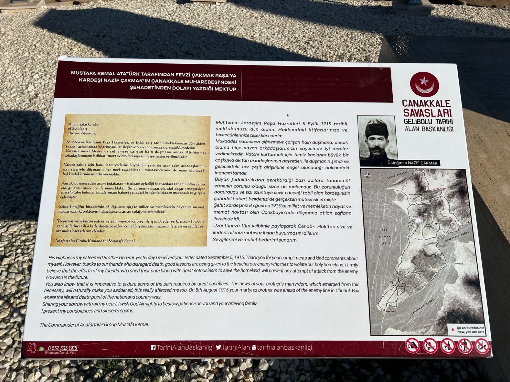
Here is an information plaque at the site.
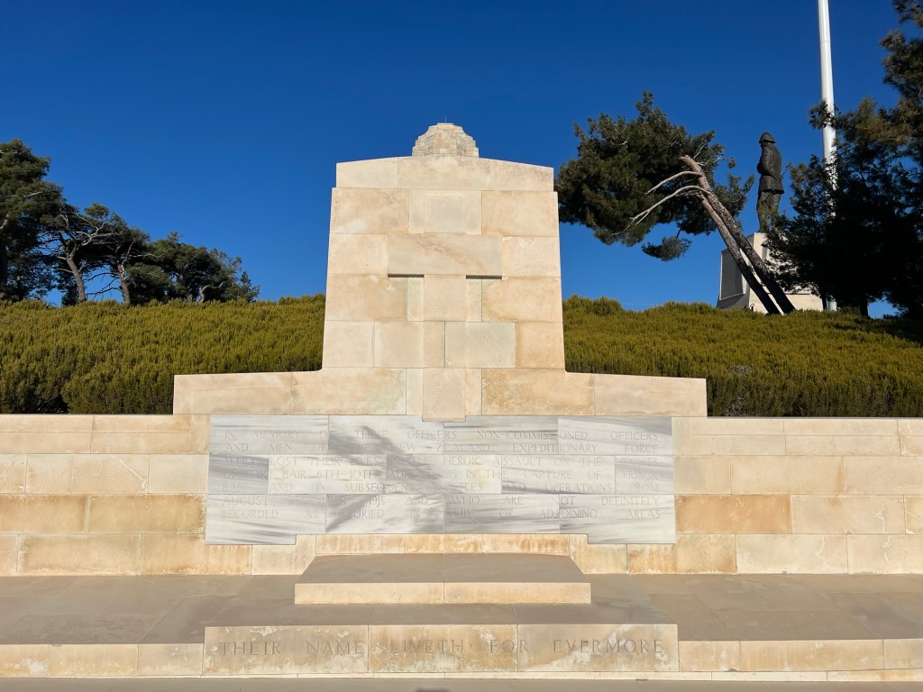
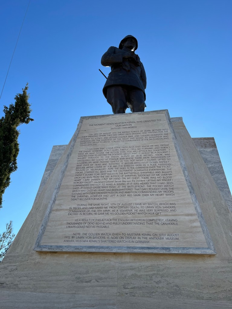
And here is a nearby statute of Mustafa Kamel Ataturk with his words of the battle.
A photo of the area from a little way back
An information plaque at the site.
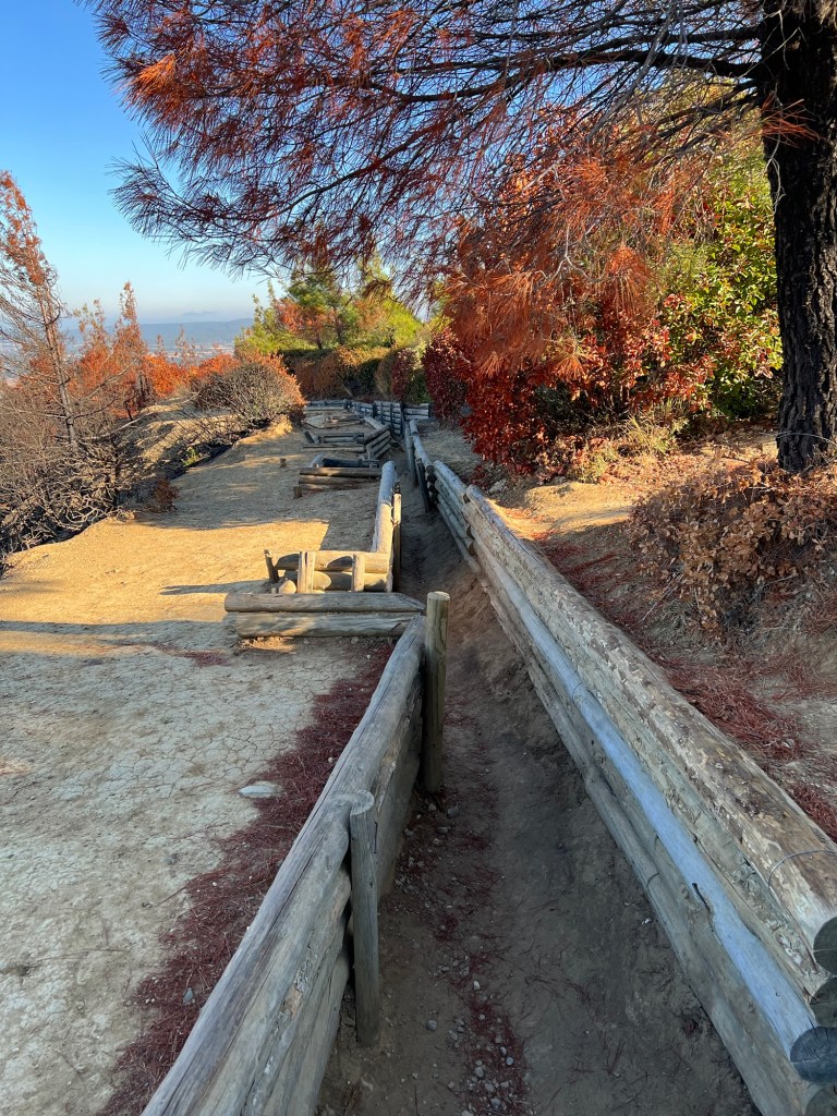
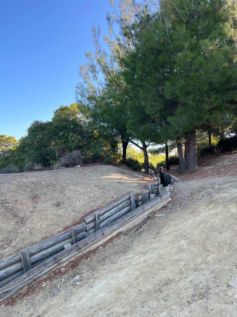
A photo of the trench system nearby
Another photo
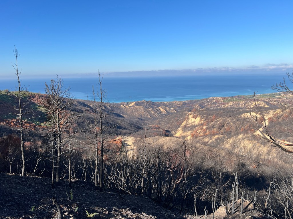
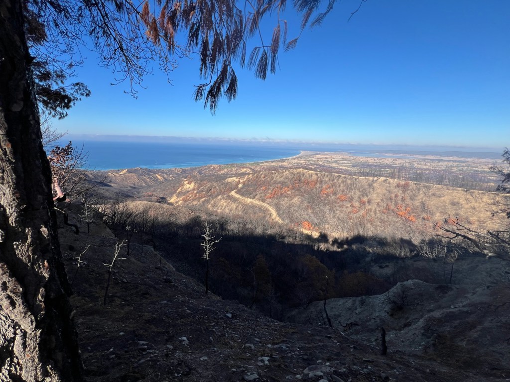
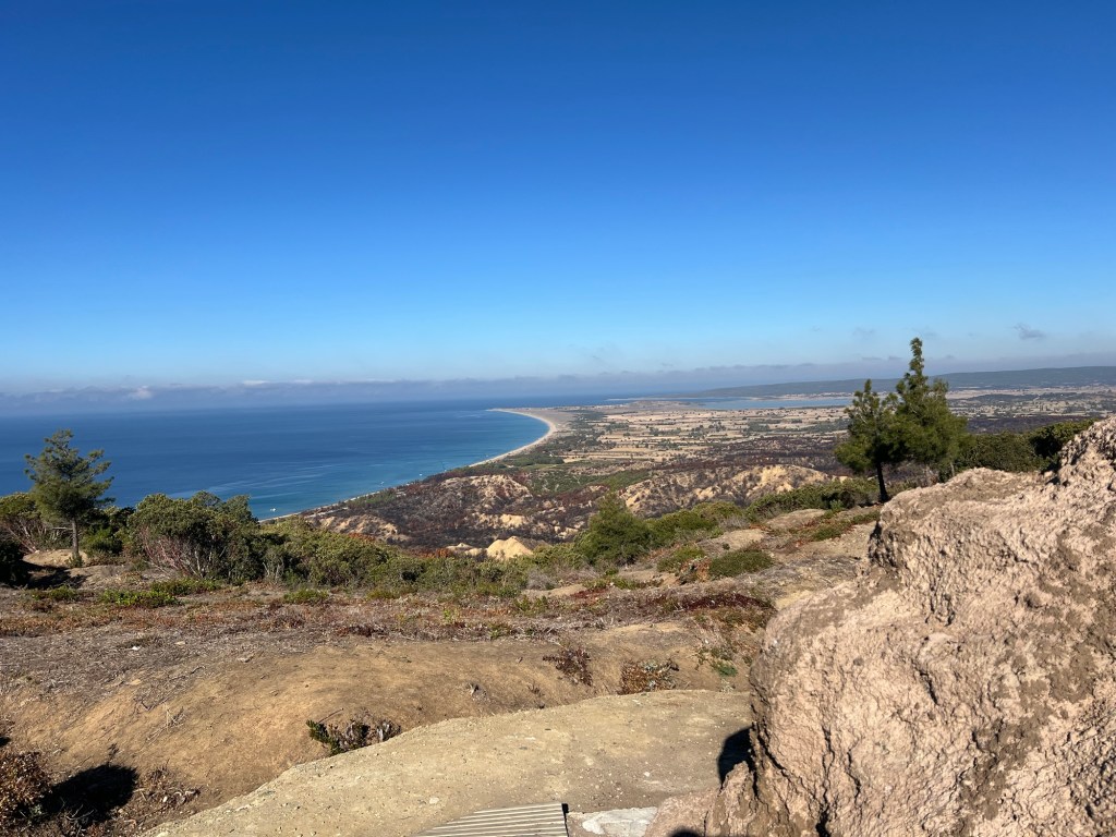
This photo was taken looking down on the area where the ANZACs would have been.
More photos looking down and across the landscape. You really don’t get an appreciation of the significance of the landscape until you see it first hand.
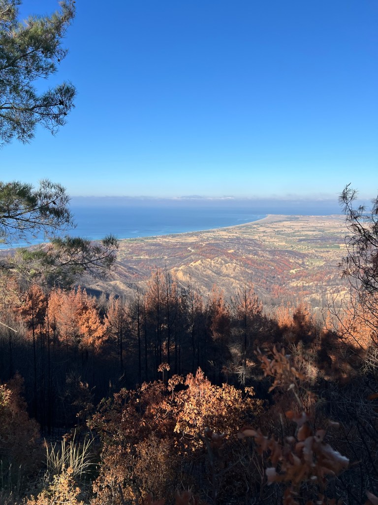
Steep inclines, ridge lines and gully’s dominate Ted landscape.
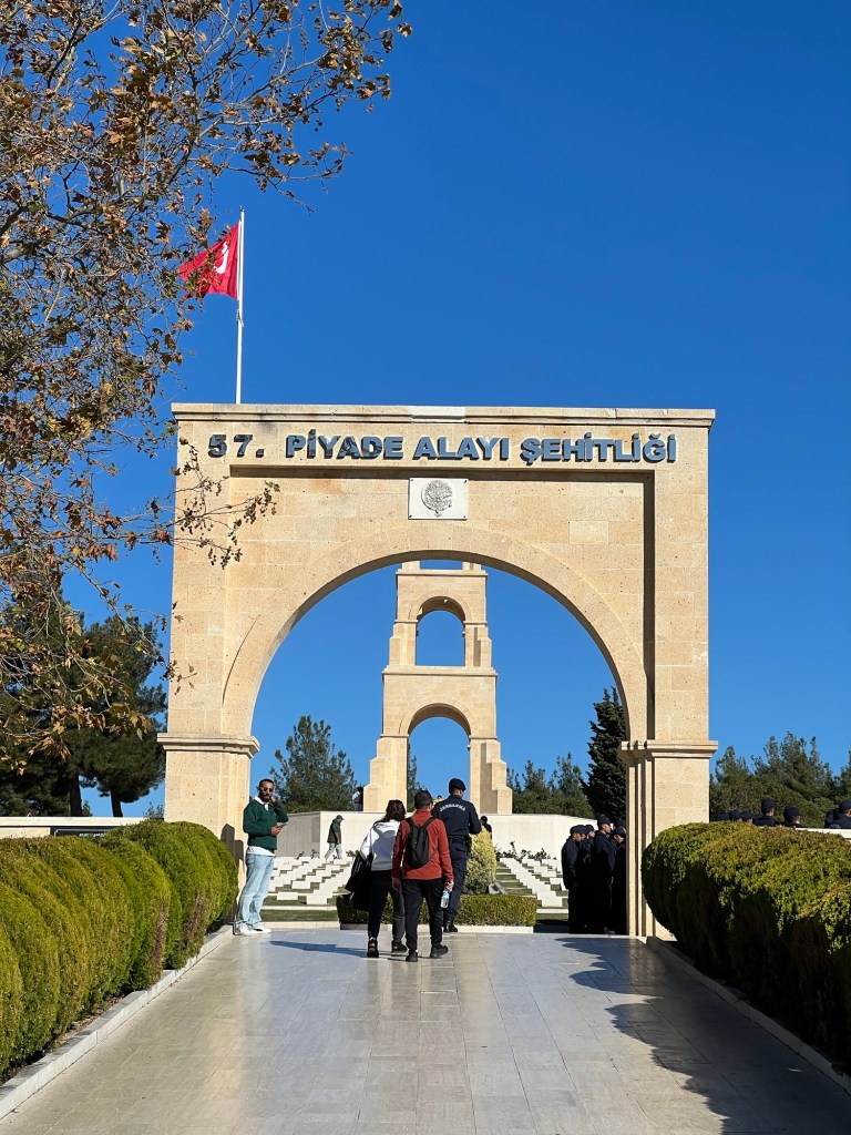
I then made my way over to Canterbury Knob and was surrounded by large stone tablets written in Turkish. Here’s a short video.
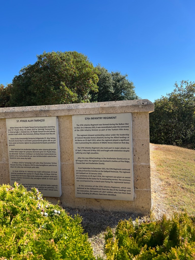
At the bottom of each tablet is a metal plaque that has in English was is written in Turkish on the stone tablets.
I was taking a photo of a metal plaque in English when l stepped back and nearly tripped over a dog that came from nowhere!

He accompanied me probably half way as l walked down. A few more photos of the terrible terrain which the ANZACs and Turks had to contend with.
They had a bush fire in the area during their summer.
Trenches near by

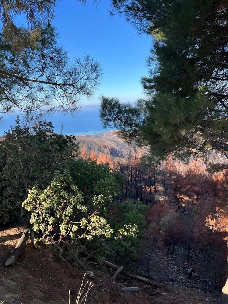
The lake looking area in the right of the below photo is actually Suvla Bay.

This was a site of another landing in August 1925. Its aim was to break the deadlock of the Gallipoli campaign.
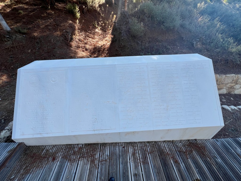
I passed a small Turkish cemetery on my way down.

The names of the Turkish soldiers who lost their lives snd buried there were engraved on the marble stone on the left.
Whenever l would eventuate off road to visit such sites the dog would find a shady place and wait for me.
A bit further down the road a came across these statues.

This was the information plaque explaining the significance of the statutes.

Another photo taken near the statutes looking back across the landscape towards Suvla Bay.
A short video of a Turkish cemetery nearby (somewhere!).
And another Turkish cemetery with the names of those who lost their lives on the marble stone.
It was interesting to note that a fair portion of names didn’t have year or date of birth included. This is where my dog left me! It was sort of nice having him following me along.

This was another cemetery for Turkish soldiers.
This was the plaque out the front.
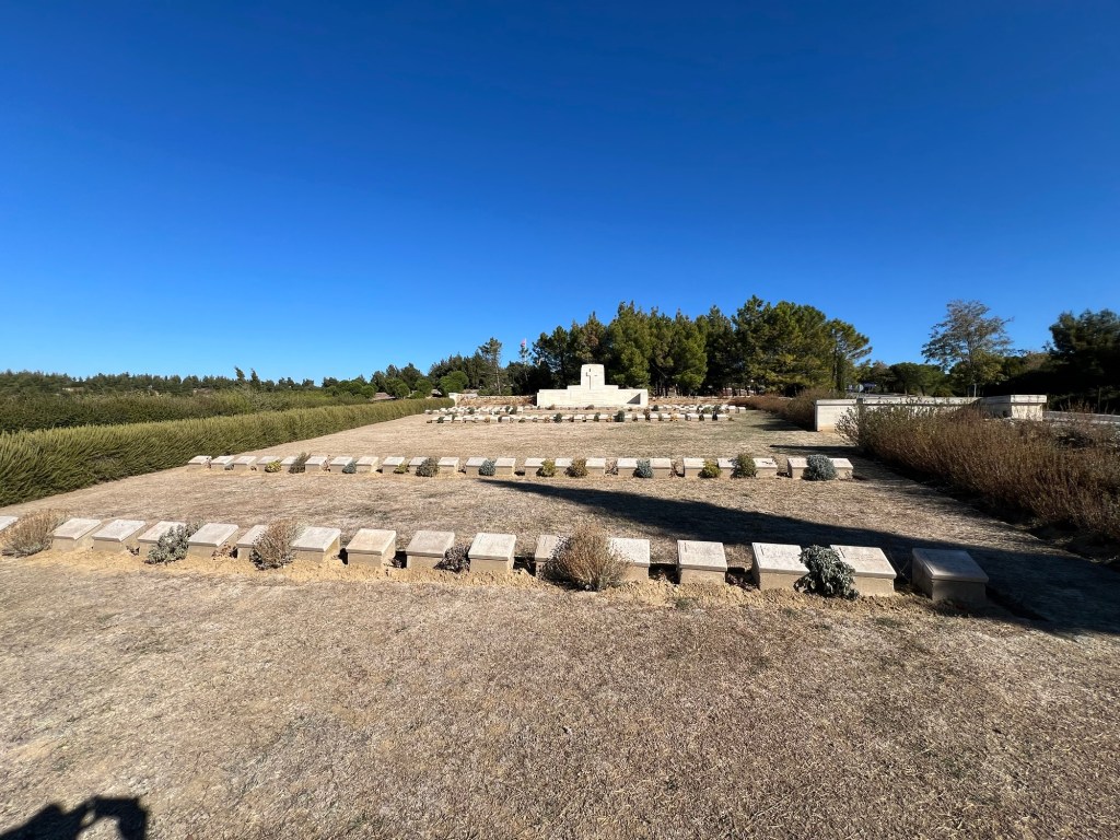
Then l arrived at Quinn’s Post cemetery.
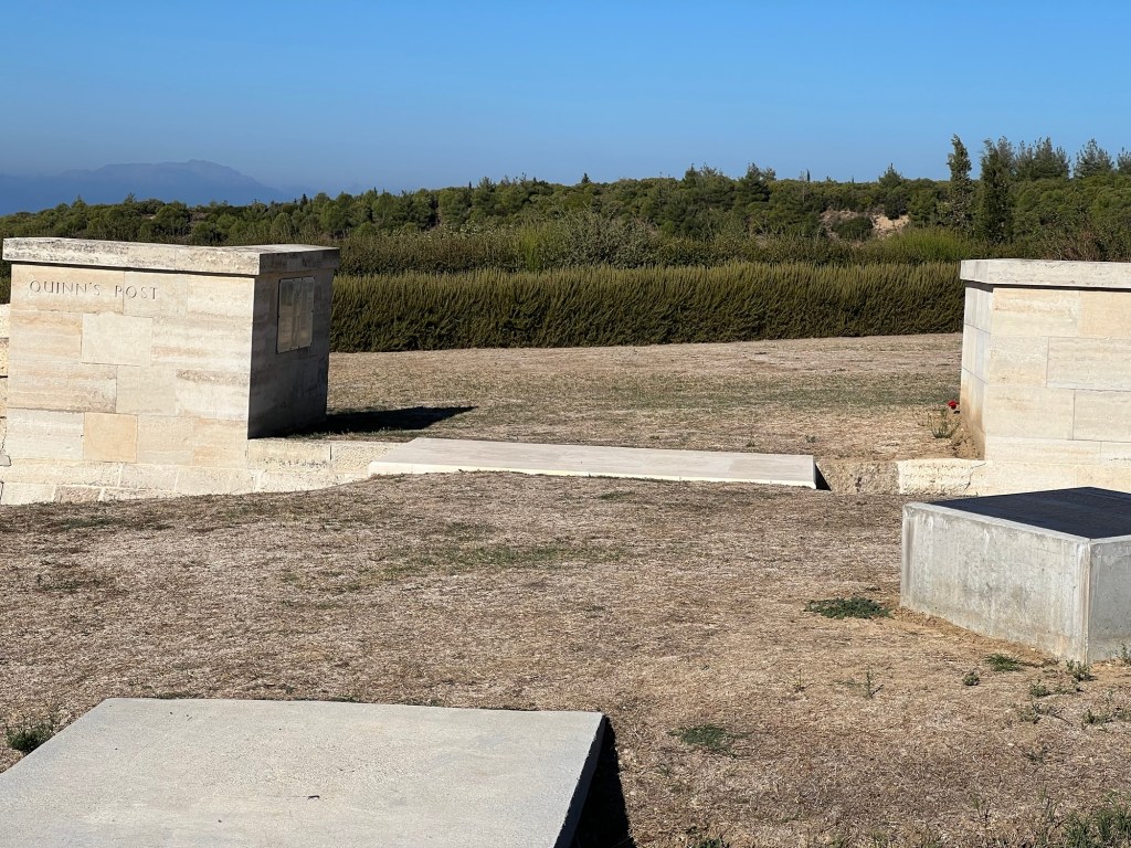
A photo from inside the cemetery.
The information plaque explaining the significance of the site.

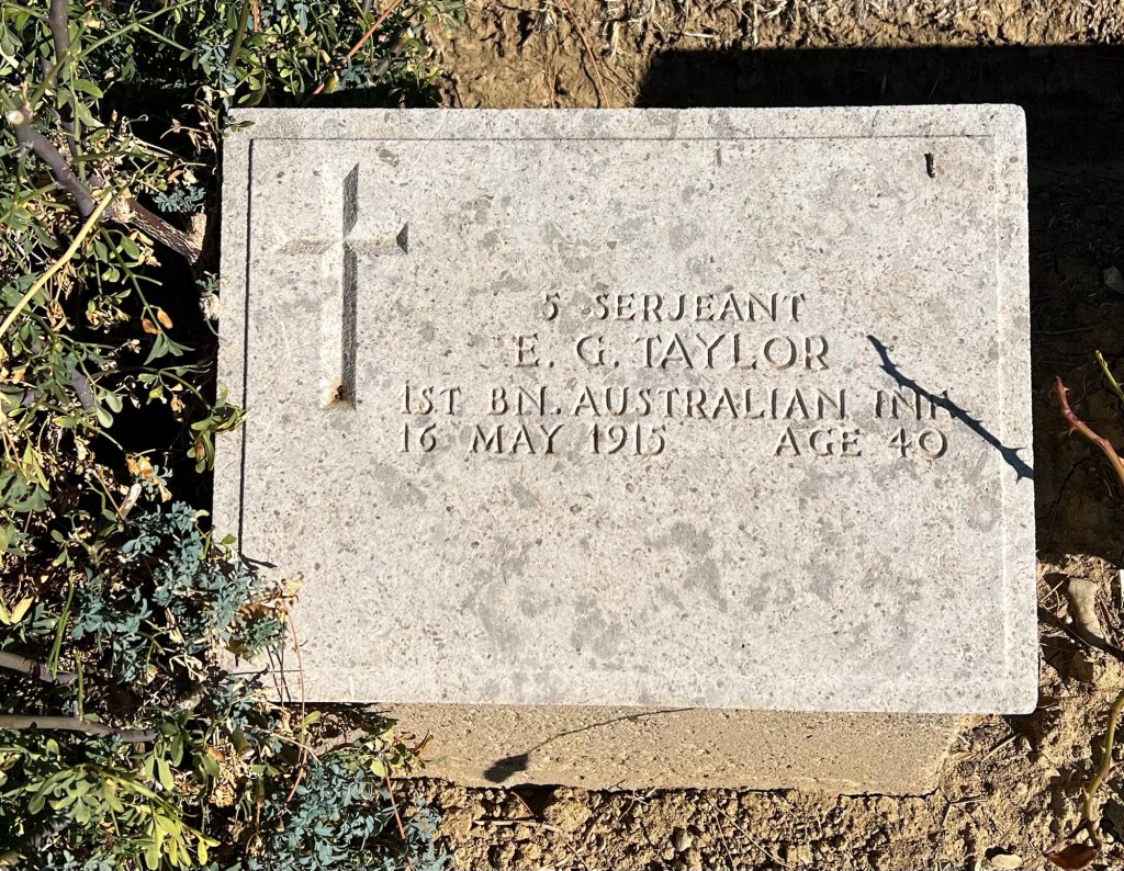
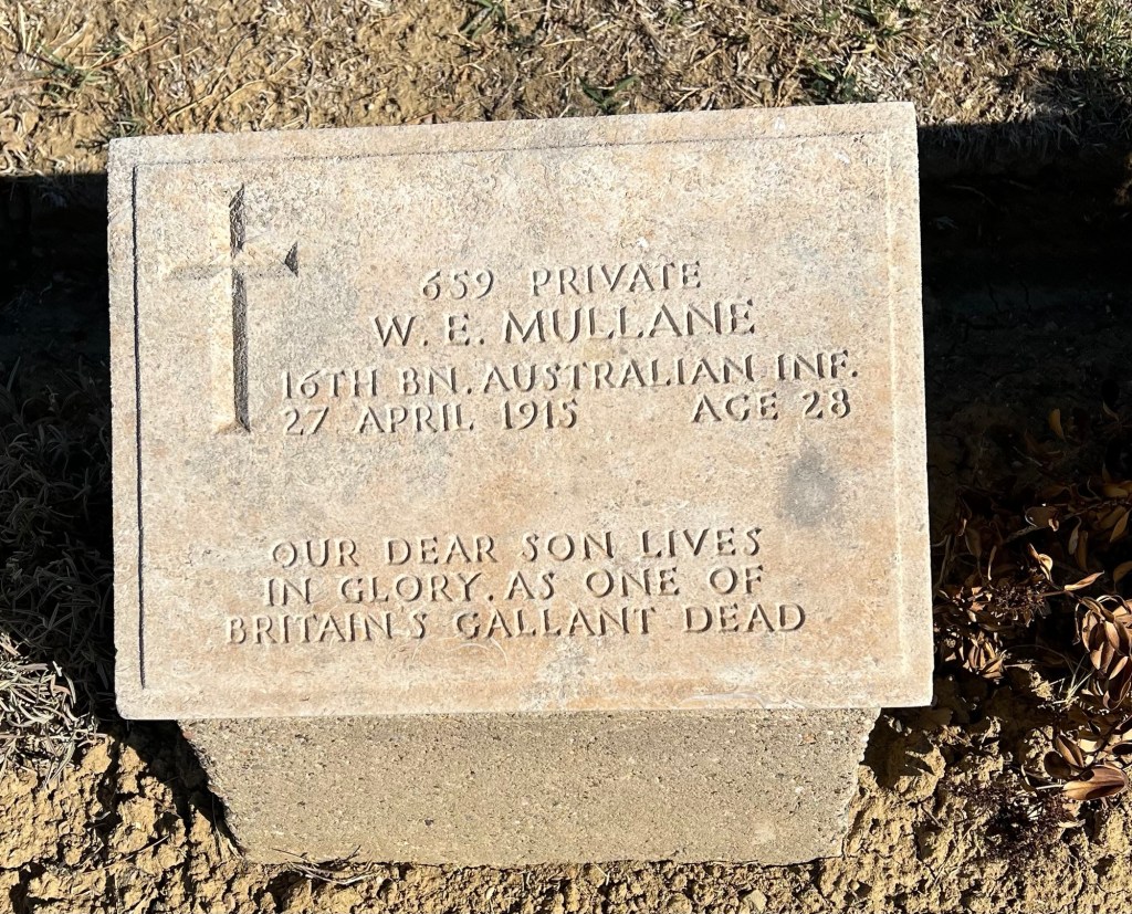
It’s interesting to note the burial of “unknown” out weigh those who were identified! A selection of grave markers within the cemetery.


Britain’s gallant dead! More information on the battle at Quinn’s Post.
Then Courtney’s and Steel’s Posts site on the peninsula.

A photo inside the cemetery

I found this graver marker interesting!

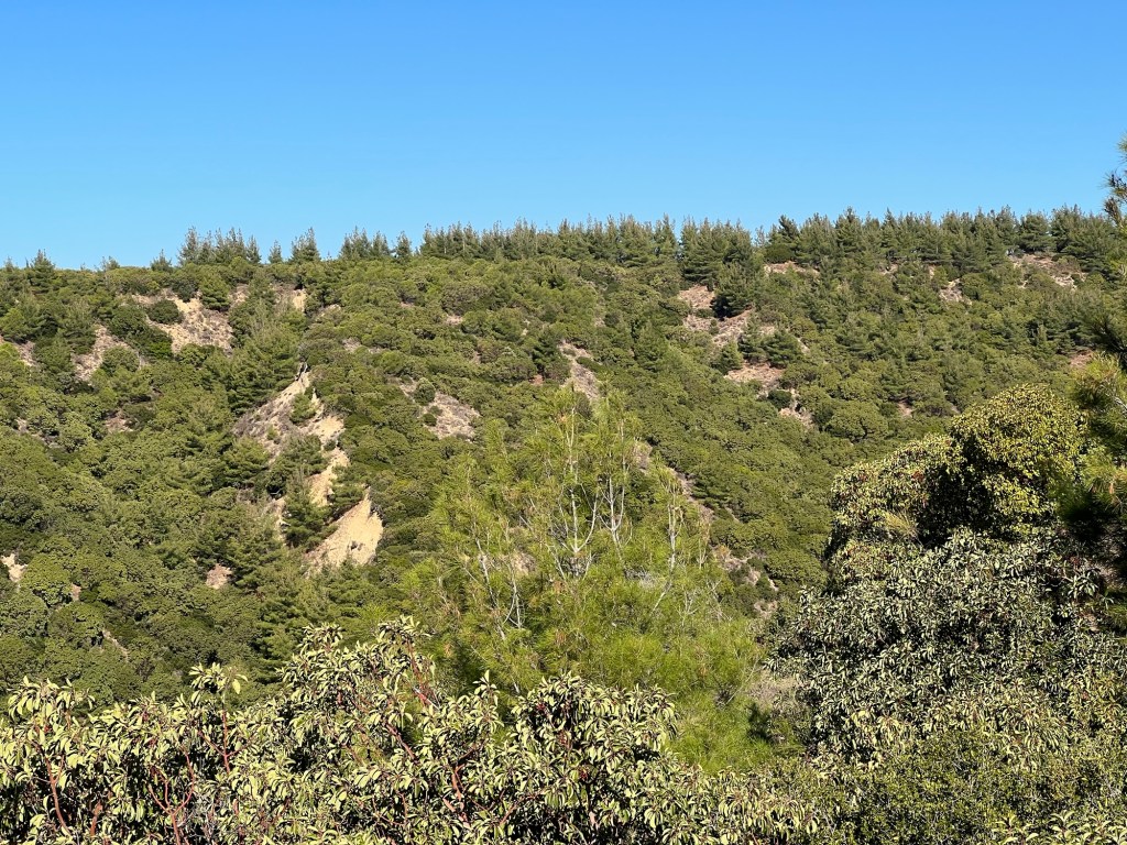
A photo of the typical terrain near Quinn’s, Courtney’s and Steel’s posts.
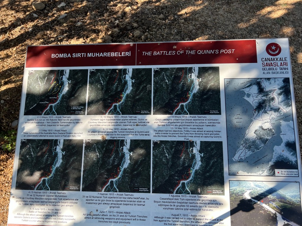
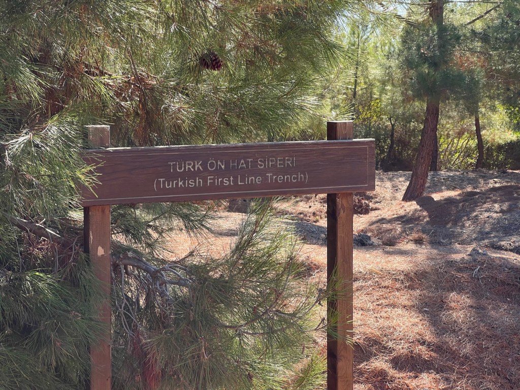
A not further down the road l discovered a series of ANZAC and Turkish trench’s (some as close as a few meters in places).

And
Trenches still in place today although they’ve eroded over the time.

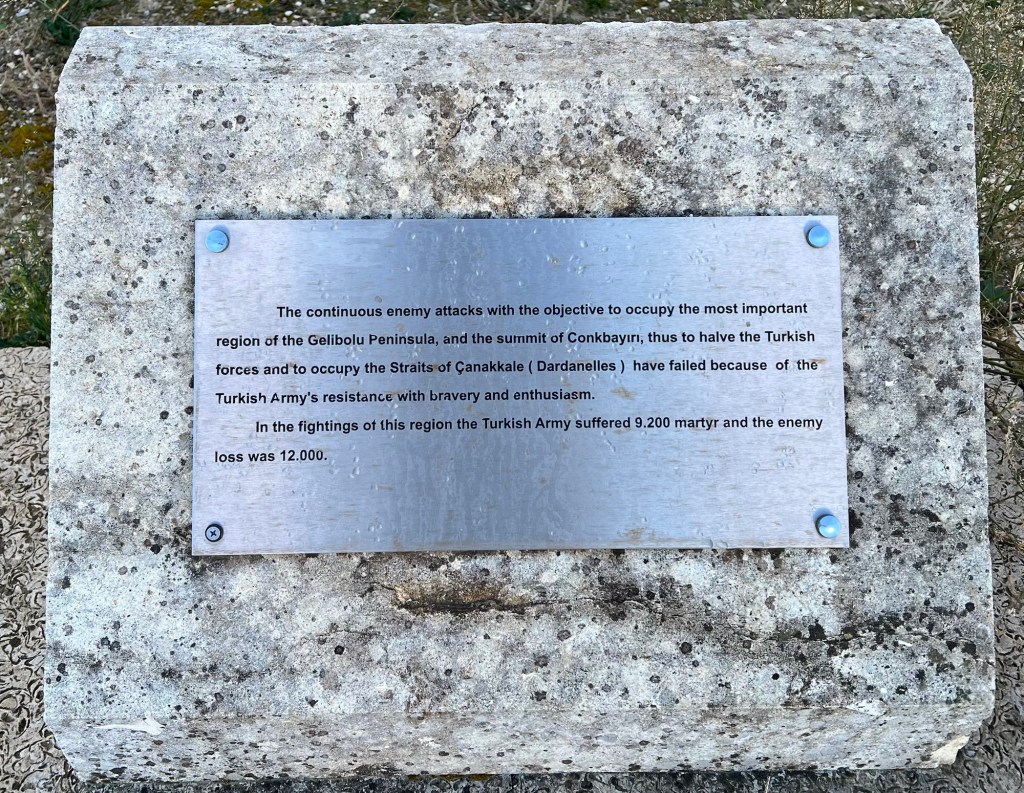
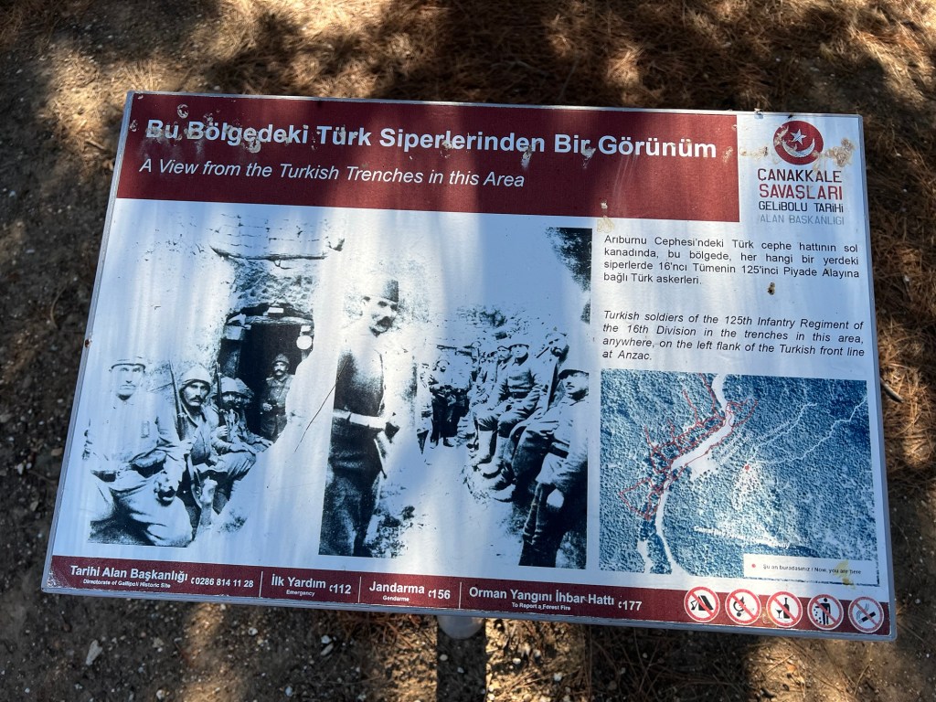
Here is a photo information showing the view of trenches from the Turkish perspective.
The cemetery at Johnston’s Jolly

Information on both Johnstone’s Jolly and Lone Pine cemeteries.
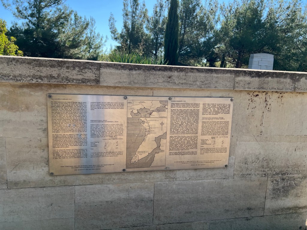
Note there were only 39 Australian lives (that they could identify) lost at during the battle over Johnston’s Jolly. The loss of Australian lives during the Lone Pine battle was 651 which with the unidentified listed as being 499 lives.
More information on Johnston’s Jolly.

I wasn’t aware on mining activities as was undertaken in Europe. But, here is a sign and an entrance to a tunnel.

Then Owen’s gully which seperates Johnston’s Jolly and Lone Pine.

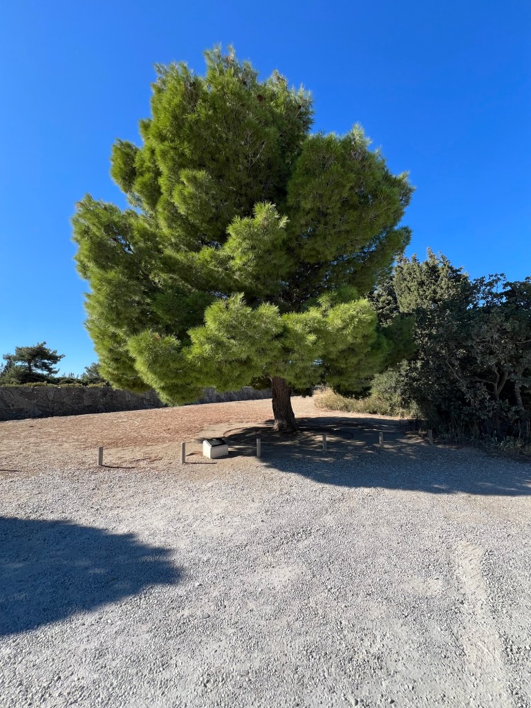
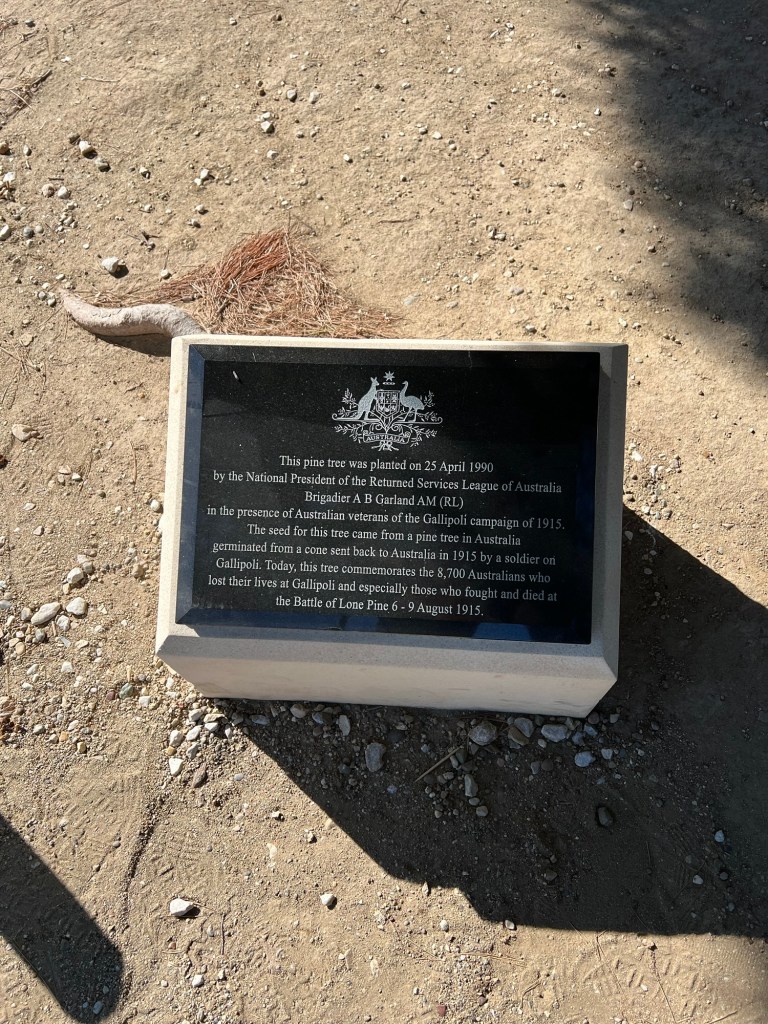
Then onto Lone Pine cemetery. A photo of a pine tree planted by the RSL in 1990 to commemorate the lives lost of those who fought in the battle for Lone Pine.
This is the plaque
Into Lone Pine cemetery.

A somber selfie

Only some of the names listed at Lone Pine cemetery.

Another photo showing Lone Pine memorial

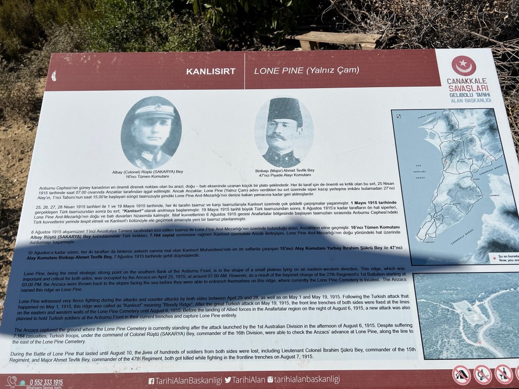
Information on Lone Pine battle.
A trench near Lone Pine.

I started back down to my next stop which was at the statute celebrating the actions of a Turkish soldier during battle.
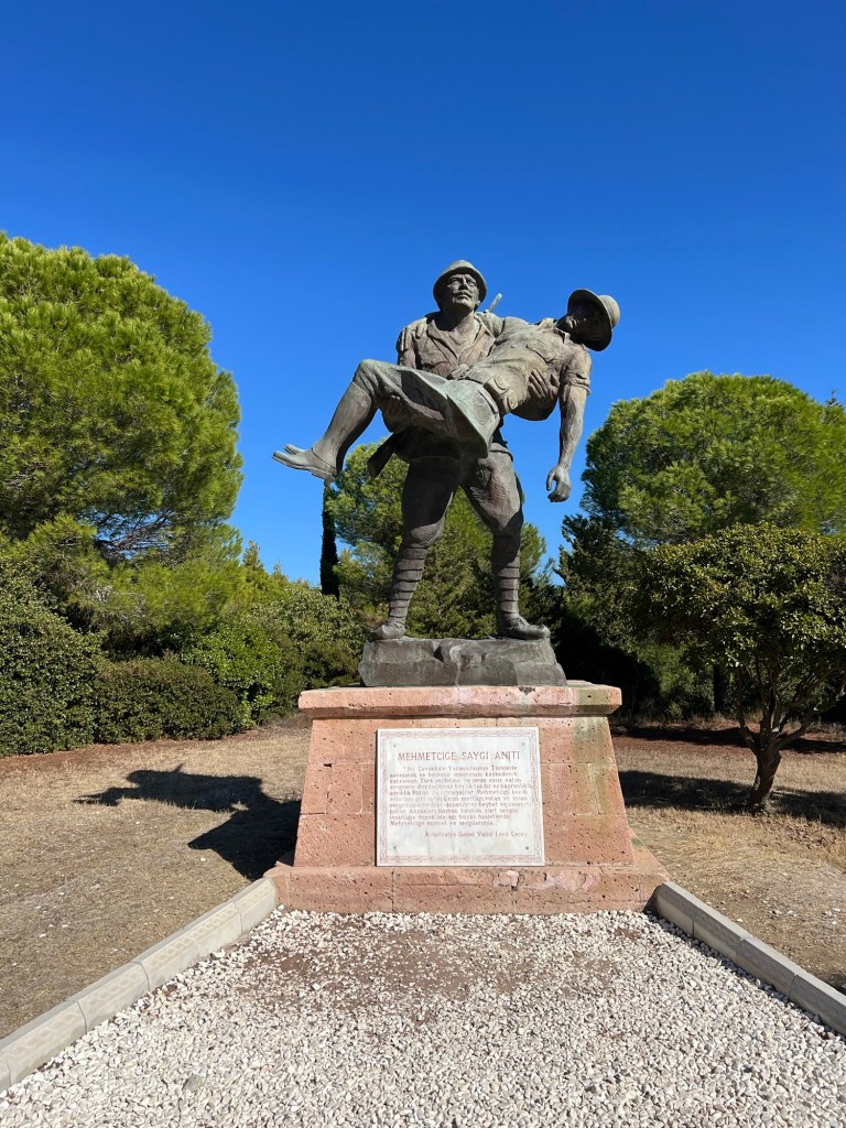
During a battle an Australian soldier was wounded and under a white flag from the Turkish trenches the above soldier carried the wounded Australian back to Australian trenches.
Then l continue l’d my journey down hill.
I passed another Turkish cemetery.
And another …
Before arriving at the sea.
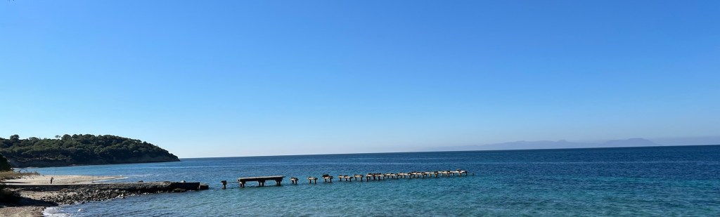
Looking in the other direction

I had a short rest then headed off on foot to make my way to the Çanakkale Epic Promotion Centre (the museum).
As long this road for nearly a kilometre.

I eventually arrived at the centre sweeting like a. Stuck pig! I brought my ticket and went in for a look.

It is well worth the stop
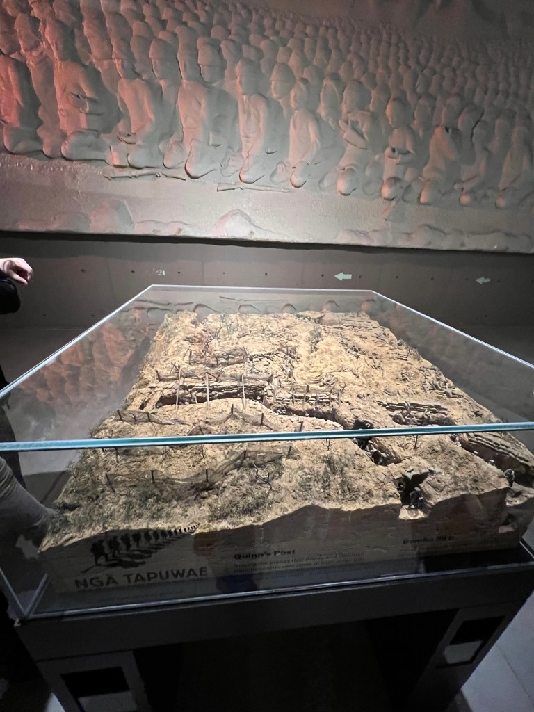
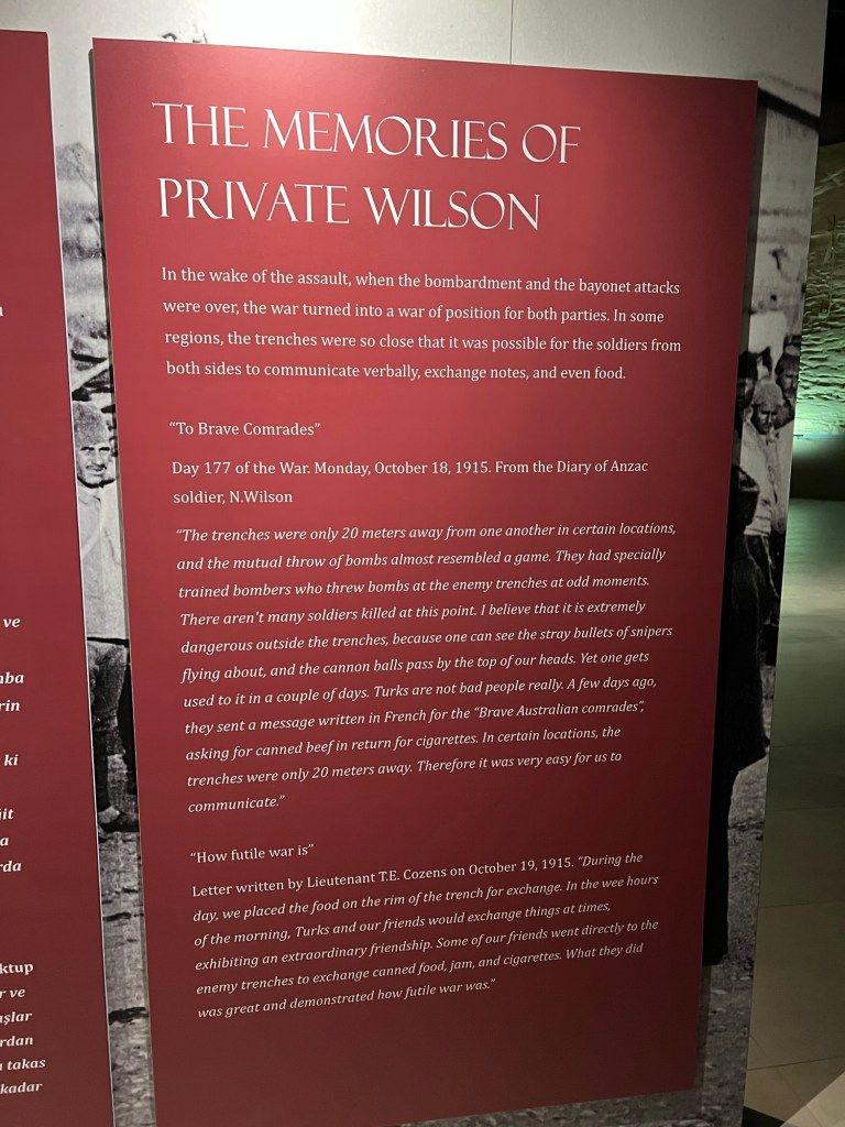
This was interesting to read … life in the trenches.
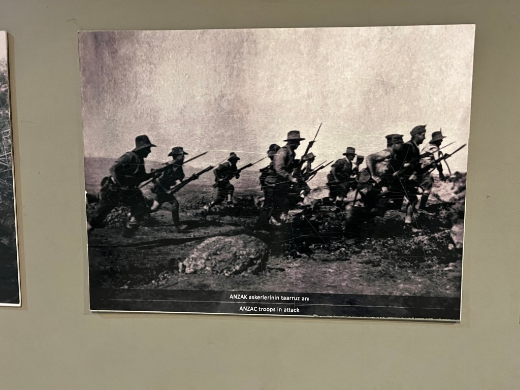
A photo of ANZACs in action
A Turkish uniform

Seeking for me for the frontlines

An Australian soldier kit on display

There was a lot of other interesting tidbits in the centre and it was well set out. After going though the centre l went outside to call the taxi driver who dropped me off in the morning. He said ten minutes. I said l’ll be waiting over at the outside cafe.
I brought a coke then sat down and get off my feet. It was 1pm by the time l had reached the Centre. By this stage, l had walked just over 9km.
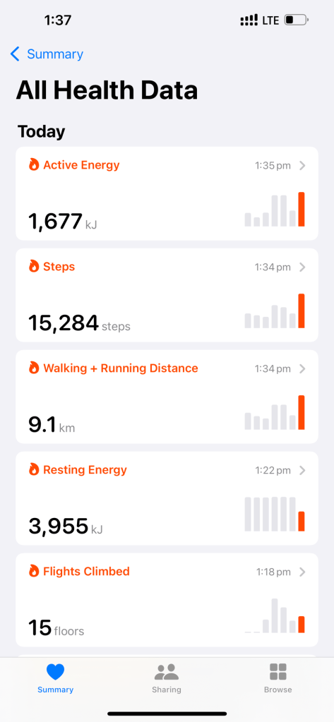
I don’t mind saying this is a big effort for me who generally would call a taxi to go around the block than walk.
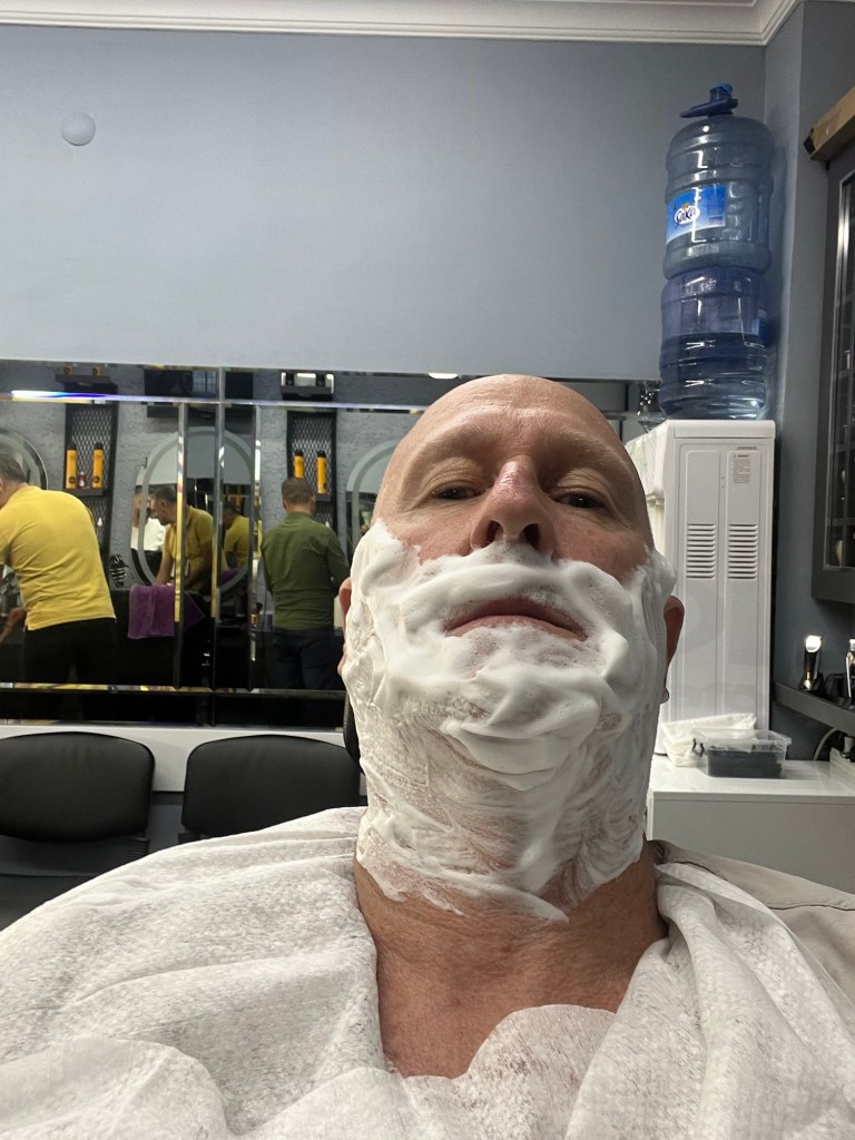
It was a long day but it didn’t stop there! A bus ride back to Gelibolu then l set off jn search of a barber. I shouted myself a hair cut (yes! A hair cut) snd an old fashioned shave!
Then back on foot to my accommodation. I then showered and called it a night. I was stuffed!

Leave a comment